Improving representation of bulk snowpack density across landscapes using advanced snow depth data
Background and Central IdeaSeasonal snowpack is an important water resource in many areas around the world. Historically, the amount of water in the snowpack (snow water equivalent, SWE) has been under-monitored with ground observations and no satellite-based sensors measures SWE reliably in all environments. A promising route to monitor and quantify SWE variability is through resolving the two main components of SWE: snow depth and density. |
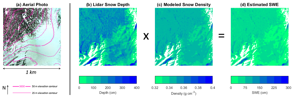
Example with airborne data from the NASA CLPX campaign over a 1 km x 1 km area near Fraser, Colorado. (a) Aerial imagery and elevation contours, (b) Lidar-measured snow depth (at 1 m horizontal resolution), and (c) modeled snow density. The product of snow depth and density yields (d) estimated SWE. |
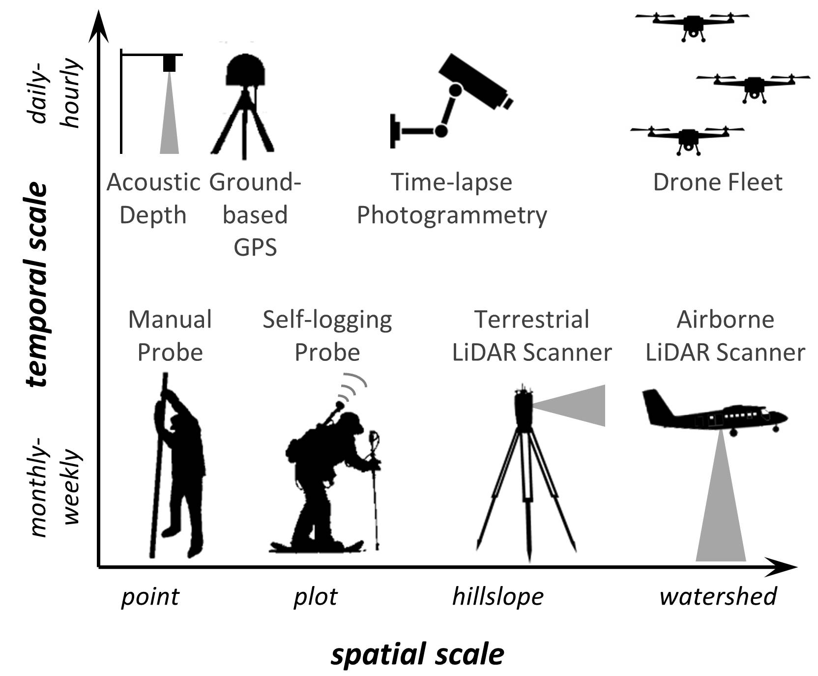
Some technologies for measuring snow depth at different scales |
State of the Science: Snow depth vs. Snow densityAn ongoing technological revolution promises to proliferate availability of snow depth data (see figure left). Approaches with LiDAR and photogrammetry (via drones or time-lapse cameras) can offer unprecedented information about spatial variability of snow depth at a range of scales/extents. Snow depth variability in time can also be monitored at local scales with networks of low-cost ultrasonic sensors and GPS stations. Technological advances have even come to the most traditional method for measuring snow depth (manual probing), through self-logging, GPS-linked snow probes that extend measurement capabilities. In contrast to snow depth measurement, there has been less progress in technologies for snow density measurement. We therefore rely on snowpack models to estimate density variations in space and time. There can be considerable uncertainty sources within and between models, and in many environments, the uncertainty in density estimation is now the chief source of SWE uncertainty. Field studies have shown that snow density exhibits variability in space (albeit more conservatively than snow depth), but the linkages to landscape processes is unclear. This research is motivated to improve the science of snow density estimation in models and to assess how snow density varies across landscapes. |
Project Goal and Science Questions(1) How do landscape-dependent physical processes control spatiotemporal variations in snowpack density? (2) How do existing models depict spatial variations in bulk snowpack density across landscapes? (3) How does the integration of advanced snow depth data into physical snow models influence uncertainty in modeled snowpack density and SWE? (4) Where are the largest regions of uncertainty in SWE across the landscape, and what are the dominant factors (e.g., uncertainties in snow depth measurement vs. snow density modeling)? (5) What is the optimal approach for estimating density, given a specific location, snow depth measurement approach, and level of data availability? We are investigating these questions through analysis of existing and new snow data collected in the field, through extensive modeling experiments, and through development of data-assimilation techniques. |
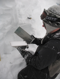
Sampling snowpack density in a snow pit |
Research Products |
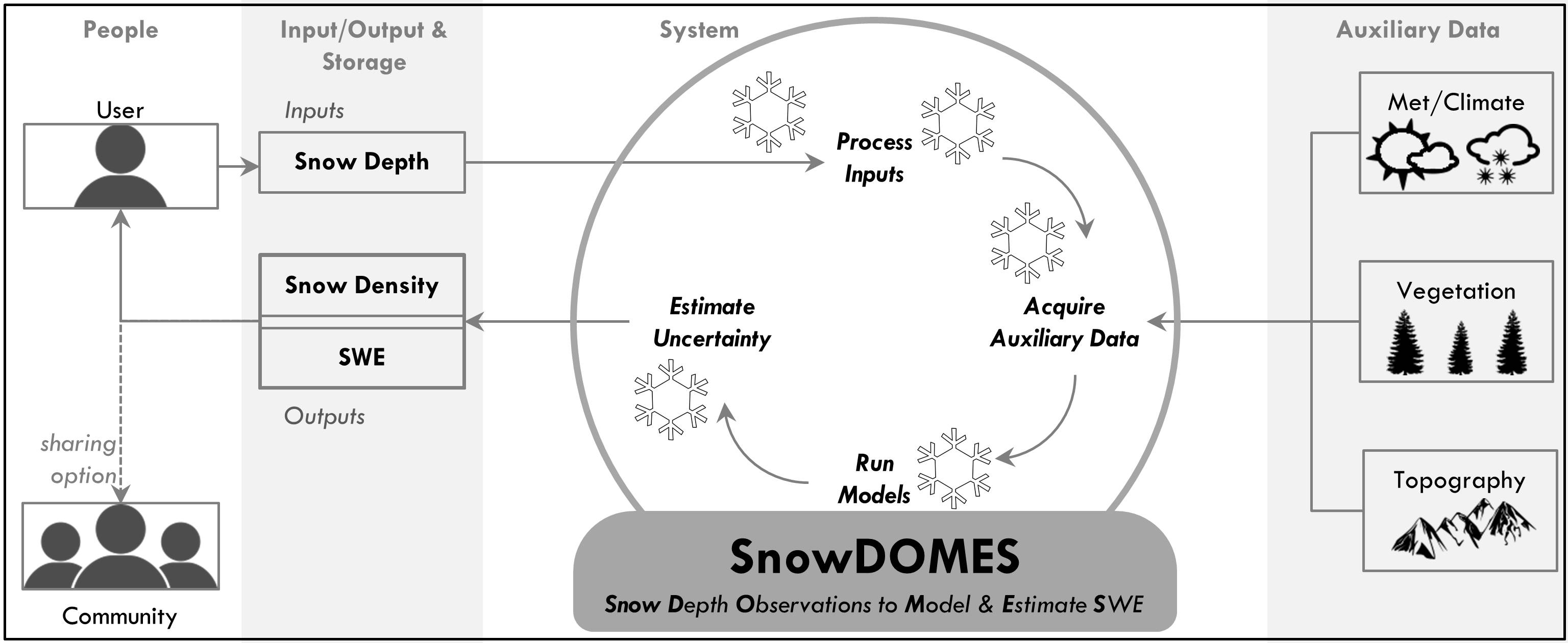
Blueprint for a system for converting snow depth data to SWE: SnowDOMES. |